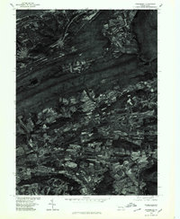
1976 Map of Orwigsburg
USGS Topo · Published 1979About this map
The ridge-and-valley landscape of Schuylkill County is clearly defined in this orthophotomap, where the parallel formations of Sharp Mountain and Second Mountain cut across the territory. Between these prominent ridges, the pattern of long, narrow agricultural fields reveals how farming was adapted to the local topography. The Schuylkill River winds through the southern portion of the quadrangle, serving as a vital corridor for the region's historic development. Established settlements like Mckeansburg and Lewistown are captured from a birds-eye perspective, showing the precise layout of roads and homesteads as they existed in the late 1970s. Near the southern border, Drehersville sits along the river, illustrating the historical importance of the waterway to small mountain communities and the regional transportation network.
Find a feature on this map
6 named features on this map. Tap any name to fly to it.
Don’t see what you’re looking for? This feature index may not catch every label — zoom into the map to look around manually.
Map Details
Editions of this 1976 Orwigsburg Map
This is the sole edition of this map. No revisions or reprints were ever made.
Other maps of this area

1889 · Hazleton
USGS Topo · 1:62,500

1889 · Pottsville
USGS Topo · 1:62,500

1891 · Hazleton
USGS Topo · 1:62,500

1891 · Pottsville
USGS Topo · 1:62,500

1892 · Mahanoy
USGS Topo · 1:62,500

1893 · Hazleton
USGS Topo · 1:62,500

1893 · Mahanoy
USGS Topo · 1:62,500

1909 · Hamburg
USGS Topo · 1:62,500

1911 · Hamburg
USGS Topo · 1:62,500

1944 · Pottsville
USGS Topo · 1:24,000
Featured Places
- Orwigsburg, PA
- New Philadelphia, PA
- Deer Lake, West Brunswick Township
- Middleport, PA
- North Manheim Township, PA