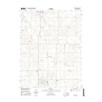
2015 Map of Osage City
USGS Topo · Published 2015About this map
Burlingame and Osage City anchor the north and south of this topographic landscape, connected by a network of rural roads and the intermittent paths of Dragoon Creek. The settlement of Peterton sits between the two larger towns, illustrating the historical distribution of small communities across the Osage County plains. This 2015 survey details several significant genealogical sites, including the Burlingame City Cem and a cluster of burial grounds near Osage City such as Union Cem and Mount Calvary Cem. The terrain is characterized by meandering waterways like Switzler Cr and Salt Cr, which contrast with the sharp relief of Elkhorn Knob. Modern infrastructure is represented by the Osage City Municipal Airport, while the underlying township and range boundaries of t15s r14e and t16s r15e reflect the enduring grid of the Public Land Survey System.
Find a feature on this map
57 named features on this map. Tap any name to fly to it.
Don’t see what you’re looking for? This feature index may not catch every label — zoom into the map to look around manually.
Map Details
Editions of this 2015 Osage City Map
This is the sole edition of this map. No revisions or reprints were ever made.
Other maps of this area

1889 · Burlingame
USGS Topo · 1:125,000

1894 · Burlingame
USGS Topo · 1:125,000

1947 · Lawrence
USGS Topo · 1:250,000

1950 · Lawrence
USGS Topo · 1:250,000

1952 · Harveyville
USGS Topo · 1:24,000

1952 · Burlingame
USGS Topo · 1:24,000

1955 · Carbondale
USGS Topo · 1:24,000

1956 · Lawrence
USGS Topo · 1:250,000

1961 · Lawrence
USGS Topo · 1:250,000
1965 · Lyndon
USGS Topo · 1:24,000