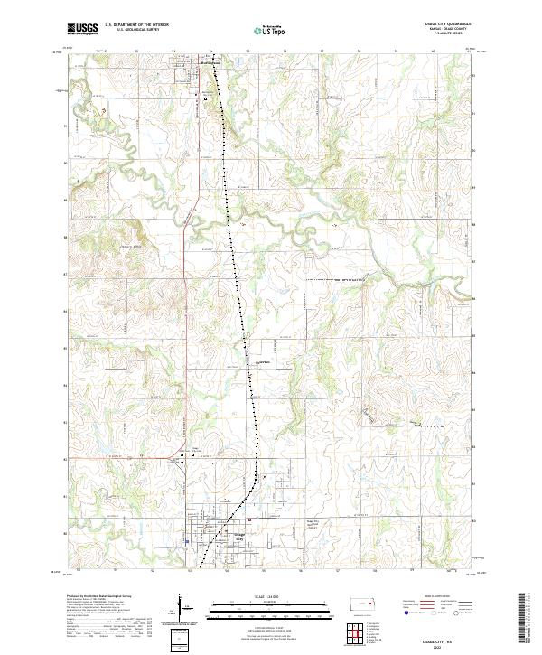
2022 Map of Osage City
USGS Topo · Published 2022About this map
Osage City and Burlingame serve as the primary hubs in this modern-day layout of Osage County, Kansas. The map documents a landscape defined by a grid of rural roads and the meandering paths of Dragoon Creek and Switzler Cr. Between these two towns lies Peterton, a smaller settlement that marks the transition from the upland prairies toward the more developed urban corridors. The presence of numerous burial grounds, including Union Cem, Mount Calvary Cem, and the Burlingame City Cem, provides essential points of reference for genealogists and local historians tracking family lineages in the region.
Find a feature on this map
84 named features on this map. Tap any name to fly to it.
Don’t see what you’re looking for? This feature index may not catch every label — zoom into the map to look around manually.
Map Details
Editions of this 2022 Osage City Map
This is the sole edition of this map. No revisions or reprints were ever made.
Other maps of this area

1889 · Burlingame
USGS Topo · 1:125,000

1894 · Burlingame
USGS Topo · 1:125,000

1947 · Lawrence
USGS Topo · 1:250,000

1950 · Lawrence
USGS Topo · 1:250,000

1952 · Harveyville
USGS Topo · 1:24,000

1952 · Burlingame
USGS Topo · 1:24,000

1955 · Carbondale
USGS Topo · 1:24,000

1956 · Lawrence
USGS Topo · 1:250,000

1961 · Lawrence
USGS Topo · 1:250,000
1965 · Lyndon
USGS Topo · 1:24,000