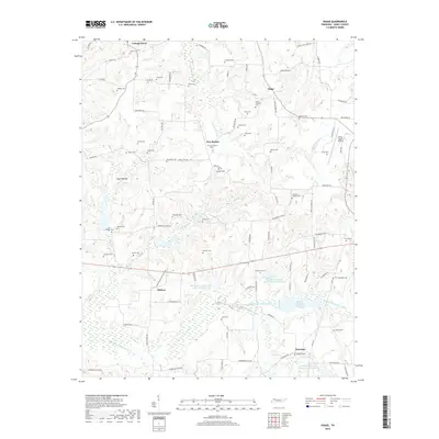
2019 Map of Osage
USGS Topo · Published 2019About this map
Cottage Grove and Osage anchor this survey of Henry County, revealing a landscape defined by its network of rural cemeteries and the slow-moving waters of the Middle Fork Obion River. Family lineages are deeply etched into the terrain through dozens of named burial grounds such as Tyler-Compton Cem, Oak Hill Cem, and Johnson Chapel Cem. These small nodes, along with settlements like New Boston and Midway, are connected by a web of traditional routes including Trading Post Rd and Jones Bend Rd.
Find a feature on this map
95 named features on this map. Tap any name to fly to it.
Don’t see what you’re looking for? This feature index may not catch every label — zoom into the map to look around manually.
Map Details
Editions of this 2019 Osage Map
This is the sole edition of this map. No revisions or reprints were ever made.
Other maps of this area

1936 · Conyersville
USGS Topo · 1:24,000

1936 · Crossland
USGS Topo · 1:24,000

1936 · Mansfield
USGS Topo · 1:24,000

1936 · Paris
USGS Topo · 1:24,000

1950 · Osage
USGS Topo · 1:24,000

1950 · Paris
USGS Topo · 1:24,000

1950 · Mansfield
USGS Topo · 1:24,000

1950 · Puryear
USGS Topo · 1:24,000

1950 · Cottage Grove
USGS Topo · 1:24,000

1955 · Henry
USGS Topo · 1:24,000