
2012 Map of Osage Hills
USGS Topo · Published 2012About this map
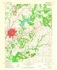
Claremore Regional Airport sits west of the community of Harmony Star, marking a landscape where agricultural roots meet modern aviation. This Rogers County terrain is defined by a dendritic network of waterways, including Panther Creek, Seminole Creek, and Chouteau Creek, which carve through the prairie. The elevation rises to Bald Knob in the northeast, offering a distinct vantage point over the rural roads and subdivisions that characterize Osage Hills. Local history and genealogy are anchored by the Vann Cemetery, located near the southern transit corridor. The map reveals a transition from traditional section-line roads to more complex residential layouts, illustrating the evolving suburban character of the region northeast of Claremore while maintaining its fundamental geographic landmarks.
Find a feature on this map
62 named features on this map. Tap any name to fly to it.
Don’t see what you’re looking for? This feature index may not catch every label — zoom into the map to look around manually.
Map Details
Editions of this 2012 Osage Hills Map
This is the sole edition of this map. No revisions or reprints were ever made.
Other maps of this area

1896 · Pryor
USGS Topo · 1:125,000

1901 · Claremore
USGS Topo · 1:125,000

1901 · Pryor
USGS Topo · 1:125,000

1914 · Claremore
USGS Topo · 1:125,000

1916 · Claremore
USGS Topo · 1:125,000

1954 · Tulsa
USGS Topo · 1:250,000

1958 · Tulsa
USGS Topo · 1:250,000

1963 · Tulsa
USGS Topo · 1:250,000
1963 · Claremore
USGS Topo · 1:24,000

1963 · Inola
USGS Topo · 1:24,000