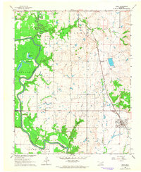
1963 Map of Inola
USGS Topo · Published 1964About this map
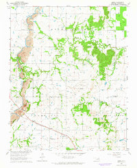
The Verdigris River snakes through the western edge of this 1963 survey, defining a landscape of oxbow lakes and alluvial lowlands like Adams Creek Bottom. To the east, the Missouri Pacific railroad serves as the primary corridor for commerce and travel, anchoring the town of Inola and the nearby siding of McFarlin. The map captures a transition between the river's flood-prone basins and the upland agricultural fields, where small rural hubs like the Gregory Church and Gregory School served local farming families.
Find a feature on this map
29 named features on this map. Tap any name to fly to it.
Don’t see what you’re looking for? This feature index may not catch every label — zoom into the map to look around manually.
Map Details
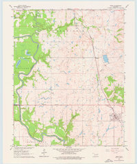
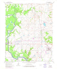
Editions of this 1963 Inola Map
3 editions found
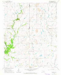
Other maps of this area

1896 · Pryor
USGS Topo · 1:125,000

1901 · Claremore
USGS Topo · 1:125,000

1901 · Pryor
USGS Topo · 1:125,000

1914 · Claremore
USGS Topo · 1:125,000

1916 · Claremore
USGS Topo · 1:125,000

1954 · Tulsa
USGS Topo · 1:250,000

1958 · Tulsa
USGS Topo · 1:250,000

1963 · Tulsa
USGS Topo · 1:250,000
1963 · Neodesha
USGS Topo · 1:24,000
1963 · Oneta
USGS Topo · 1:24,000