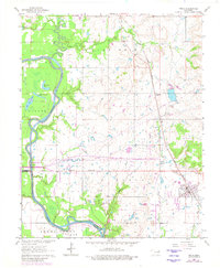
1963 Map of Inola
USGS Topo · Published 1980About this map
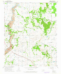
The Verdigris River snakes through the heart of this Rogers and Wagoner County landscape, shaping the lowlands of the Adams Creek Bottom. During the early 1960s, the rural character of the region was defined by small community hubs such as Inola and the rail-stop at McFarlin. The presence of numerous Oil Wells and several Gravel Pits reflects a mid-century economy tied closely to resource extraction and the river's proximity. Cultural life centered on local institutions like Gregory Ch and Gregory Sch, while the Missouri Pacific railroad provided a vital transit corridor parallel to the river's winding course. This map also details early recreation areas, including the Highway 33 Landing Public Use Area and Rocky Point Public Use Area, capturing a period of transition as infrastructure began to settle around the oxbow lakes like Big Flag Lake and Little Flag Lake.
Find a feature on this map
30 named features on this map. Tap any name to fly to it.
Don’t see what you’re looking for? This feature index may not catch every label — zoom into the map to look around manually.
Map Details
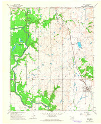
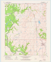
Editions of this 1963 Inola Map
3 editions found
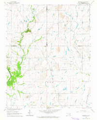
Other maps of this area

1896 · Pryor
USGS Topo · 1:125,000

1901 · Claremore
USGS Topo · 1:125,000

1901 · Pryor
USGS Topo · 1:125,000

1914 · Claremore
USGS Topo · 1:125,000

1916 · Claremore
USGS Topo · 1:125,000

1954 · Tulsa
USGS Topo · 1:250,000

1958 · Tulsa
USGS Topo · 1:250,000

1963 · Tulsa
USGS Topo · 1:250,000
1963 · Neodesha
USGS Topo · 1:24,000
1963 · Oneta
USGS Topo · 1:24,000