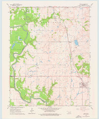
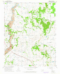
1963 Map of Inola
USGS Topo · Published 1976About this map
The Verdigris River snakes through the western portion of this landscape, creating a complex series of oxbows and backwaters including Horseshoe Lake, Little Flag Lake, and Big Flag Lake. The river's floodplain, notably the Adams Creek Bottom, contrasts with the rising ground of the Inola and Catoosa areas. In the early 1960s, the region's economy is clearly defined by its infrastructure, from the Missouri Pacific railroad corridor to numerous Oil Wells and Gravel Pits dotting the terrain. Rural community life is anchored by landmarks like Gregory Sch, Gregory Ch, and Willieo Ch, while the settlement of Inola serves as a local hub. The map captures the transition of the land as it balances traditional agriculture and river-based geography with growing industrial extraction.
Find a feature on this map
30 named features on this map. Tap any name to fly to it.
Don’t see what you’re looking for? This feature index may not catch every label — zoom into the map to look around manually.
Map Details
Editions of this 1963 Inola Map
3 editions found
Other maps of this area

1896 · Pryor
USGS Topo · 1:125,000

1901 · Claremore
USGS Topo · 1:125,000

1901 · Pryor
USGS Topo · 1:125,000

1914 · Claremore
USGS Topo · 1:125,000

1916 · Claremore
USGS Topo · 1:125,000

1954 · Tulsa
USGS Topo · 1:250,000

1958 · Tulsa
USGS Topo · 1:250,000

1963 · Tulsa
USGS Topo · 1:250,000
1963 · Neodesha
USGS Topo · 1:24,000
1963 · Oneta
USGS Topo · 1:24,000