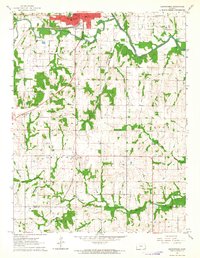
1963 Map of Osawatomie
USGS Topo · Published 1964About this map
John Brown State Park overlooks the confluence of the Pottawatomie Creek and the Marais Des Cygnes River, anchoring the historic northern edge of this 1963 survey. The rail network of the Missouri Pacific and Missouri Kansas Texas lines defines the transportation corridor through Osawatomie, while the surrounding landscape transitions into a mix of rural school districts and active energy extraction.
Find a feature on this map
31 named features on this map. Tap any name to fly to it.
Don’t see what you’re looking for? This feature index may not catch every label — zoom into the map to look around manually.
Map Details
Editions of this 1963 Osawatomie Map
2 editions found
Other maps of this area

1885 · Garnett
USGS Topo · 1:125,000

1885 · Lawrence
USGS Topo · 1:125,000

1887 · Olathe
USGS Topo · 1:125,000

1887 · Mound City
USGS Topo · 1:125,000

1889 · Lawrence
USGS Topo · 1:125,000

1893 · Mound City
USGS Topo · 1:125,000

1893 · Olathe
USGS Topo · 1:125,000

1894 · Garnett
USGS Topo · 1:125,000

1947 · Lawrence
USGS Topo · 1:250,000

1950 · Lawrence
USGS Topo · 1:250,000