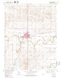
1953 Map of Osborne
USGS Topo · Published 1979About this map
The South Fork Solomon River defines the central landscape of this mid-century survey, where the township of Osborne serves as a vital rail hub. The convergence of the Missouri Pacific and the Atchison Topeka and Santa Fe railroads underscores the town's importance as an agricultural and transport center. Significant local infrastructure is visible, including the Osborne Municipal Airport and the County Fairground on the town's eastern edge.
Find a feature on this map
23 named features on this map. Tap any name to fly to it.
Don’t see what you’re looking for? This feature index may not catch every label — zoom into the map to look around manually.
Map Details
Editions of this 1953 Osborne Map
3 editions found
Other maps of this area

1893 · Smith Center
USGS Topo · 1:125,000

1896 · Osborne
USGS Topo · 1:125,000

1953 · Downs South
USGS Topo · 1:24,000

1953 · Bloomington
USGS Topo · 1:24,000

1953 · Osborne
USGS Topo · 1:24,000

1955 · Beloit
USGS Topo · 1:250,000

1959 · Beloit
USGS Topo · 1:250,000

1960 · Downs North
USGS Topo · 1:24,000

1961 · Portis
USGS Topo · 1:24,000

1961 · Harlan
USGS Topo · 1:24,000