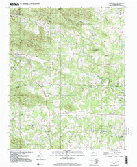
1997 Map of Osbornville
USGS Topo · Published 2000About this map
Osbornville and the surrounding rural communities of the Brushy Mountains are documented here through imagery verified at the close of the twentieth century. The landscape is defined by its numerous small-scale religious landmarks and family-named knobs, illustrating a deeply rooted settlement pattern in the foothills where Wilkes Co, Iredell Co, and Yadkin Co converge. Significant local centers like Somers Crossroads and Jennings are linked by winding roads through valleys such as Pasture Bottom. Waterways like Hunting Creek and Rocky Creek carve through the terrain, passing landmarks such as Union Ch and Smyrna Chapel. The density of country churches, including Mt Pisgah Ch and Mountain View Ch, highlights the cultural centerpoints for genealogists and local historians tracing the development of these North Carolina uplands.
Find a feature on this map
44 named features on this map. Tap any name to fly to it.
Don’t see what you’re looking for? This feature index may not catch every label — zoom into the map to look around manually.
Map Details
Editions of this 1997 Osbornville Map
This is the sole edition of this map. No revisions or reprints were ever made.
Other maps of this area

1889 · Wilkesboro
USGS Topo · 1:125,000

1891 · Wilkesboro
USGS Topo · 1:125,000

1891 · Yadkinville
USGS Topo · 1:125,000

1893 · Statesville
USGS Topo · 1:125,000

1893 · Yadkinville
USGS Topo · 1:125,000

1895 · Hickory
USGS Topo · 1:125,000

1953 · Charlotte
USGS Topo · 1:250,000

1953 · Winston-Salem
USGS Topo · 1:250,000

1954 · Charlotte
USGS Topo · 1:250,000

1955 · Winston-Salem
USGS Topo · 1:250,000