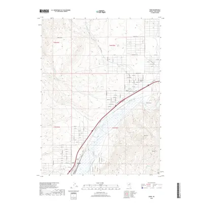
2018 Map of Osino
USGS Topo · Published 2018About this map
The Humboldt River corridor defines the valley floor here, serving as a primary artery for transportation and settlement between the Adobe Range and the Elko Hills. In this high desert landscape, the community of Osino sits near the mouth of Jackstone Canyon, where residential developments like Indian Hills Dr and Mesaverde Dr follow the alluvial fans. Further southwest, the northeastern edge of Elko begins to emerge, anchored by the rail siding at Coin. The terrain is marked by sharp relief, including the prominent Elko Mtn and West Peak. Numerous ephemeral waterways, such as White Rock Cr and Sheep Cr, carve through the basin toward the main river. This map shows the modern expansion of infrastructure along Old Hwy 40 and E Idaho St, illustrating how contemporary development navigates the constraints of the Great Basin topography.
Find a feature on this map
103 named features on this map. Tap any name to fly to it.
Don’t see what you’re looking for? This feature index may not catch every label — zoom into the map to look around manually.
Map Details
Editions of this 2018 Osino Map
This is the sole edition of this map. No revisions or reprints were ever made.
Other maps of this area

1955 · Wells
USGS Topo · 1:250,000

1955 · Elko
USGS Topo · 1:250,000

1957 · Elko West
USGS Topo · 1:24,000

1957 · Elko East
USGS Topo · 1:24,000

1958 · Wells
USGS Topo · 1:250,000

1958 · Elko
USGS Topo · 1:250,000

1961 · Wells
USGS Topo · 1:250,000

1962 · Elko
USGS Topo · 1:250,000

1962 · Kittridge Springs
USGS Topo · 1:24,000

1962 · Boyd Reservoir
USGS Topo · 1:24,000