
1957 Map of Elko West
USGS Topo · Published 1958About this map
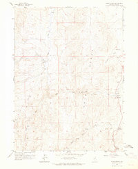
The Humboldt River corridor dominates this mid-century landscape, serving as the vital artery for transportation and settlement in northeastern Nevada. The city of Elko is depicted as a thriving hub where the Southern Pacific and Western Pacific railroads parallel the water, supporting a network of infrastructure including the Elko Municipal Airport and Elko County Fairgrounds. To the north, the Elko Colony Indian Reservation sits adjacent to the developing city grid, while the southern reaches of the map reveal the older transportation heritage of the region through the Elko-Hamilton Stage Route winding through Fourmile Canyon. From the civic center marked by the Courthouse and High Sch to the industrial Oil Tanks and Sewage Disposal Plant, this survey documents a period of significant post-war stabilization in this high-desert community.
Find a feature on this map
47 named features on this map. Tap any name to fly to it.
Don’t see what you’re looking for? This feature index may not catch every label — zoom into the map to look around manually.
Map Details
Editions of this 1957 Elko West Map
This is the sole edition of this map. No revisions or reprints were ever made.
Other maps of this area

1952 · Dixie Flats
USGS Topo · 1:62,500

1955 · Elko
USGS Topo · 1:250,000

1957 · Elko East
USGS Topo · 1:24,000

1958 · Elko
USGS Topo · 1:250,000

1958 · Hunter
USGS Topo · 1:24,000

1958 · Doby Summit
USGS Topo · 1:24,000

1962 · Elko
USGS Topo · 1:250,000

1962 · Kittridge Springs
USGS Topo · 1:24,000

1962 · Osino
USGS Topo · 1:24,000
1962 · Adobe Summit
USGS Topo · 1:24,000