
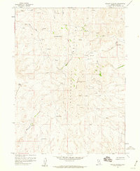
1958 Map of Hunter
USGS Topo · Published 1960About this map
The Humboldt River corridor defines the southern landscape of this Elko County region, where the competing alignments of the Southern Pacific and Western Pacific railroads trace the river's winding course. This infrastructure hub, centered near the settlement of Hunter, reflects the critical transportation networks of the late 1950s. Away from the river valley, the terrain is shaped by an intricate drainage system including Susie Creek, Middle Susie Creek, and Dry Susie Creek, leading toward more isolated features like Upper Dry Susie Spring. Survey markers such as Mike VABM 6718 and Steve VABM 6275 provide exact reference points for the high ground overlooking the basin. Small-scale industrial activity is evident through various Prospects and a Quarry near the rail lines, while a lone Airway Beacon indicates the era's navigational aids for local aviation.
Find a feature on this map
19 named features on this map. Tap any name to fly to it.
Don’t see what you’re looking for? This feature index may not catch every label — zoom into the map to look around manually.
Map Details
Editions of this 1958 Hunter Map
This is the sole edition of this map. No revisions or reprints were ever made.
Other maps of this area

1952 · Dixie Flats
USGS Topo · 1:62,500

1952 · Carlin
USGS Topo · 1:62,500

1955 · Winnemucca
USGS Topo · 1:250,000

1955 · Elko
USGS Topo · 1:250,000

1957 · Elko West
USGS Topo · 1:24,000

1958 · Winnemucca
USGS Topo · 1:250,000

1958 · Elko
USGS Topo · 1:250,000

1958 · Huntsman Ranch
USGS Topo · 1:24,000

1958 · Doby Summit
USGS Topo · 1:24,000
1958 · Swales Mountain
USGS Topo · 1:24,000