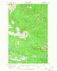
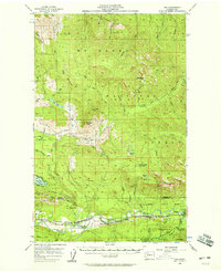
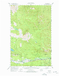
1956 Map of Oso
USGS Topo · Published 1965About this map
The North Fork Stillaguamish River corridor serves as the primary artery for settlement and industry in this mid-century survey of the North Cascades foothills. Small trackside communities including Oso, Halterman, Rowan, and Hazel line the Northern Pacific railroad, reflecting an era when rail transport was central to the local timber and river economy. The State Fish Hatchery near the river and the French Creek Forest Camp indicate the region's managed natural resources and burgeoning recreational use.
Find a feature on this map
46 named features on this map. Tap any name to fly to it.
Don’t see what you’re looking for? This feature index may not catch every label — zoom into the map to look around manually.
Map Details
Editions of this 1956 Oso Map
Other maps of this area

1899 · Stillaguamish
USGS Topo · 1:125,000

1901 · Stilaguamish
USGS Topo · 1:125,000

1909 · Mt Baker
USGS Topo · 1:192,000

1911 · Mount Vernon
USGS Topo · 1:125,000

1915 · Mt. Baker
USGS Topo · 1:250,000

1921 · Wickersham
USGS Topo · 1:62,500

1941 · Marysville
USGS Topo · 1:62,500

1943 · Marysville
USGS Topo · 1:62,500

1944 · Clear Lake
USGS Topo · 1:62,500
1951 · Wickersham
USGS Topo · 1:62,500