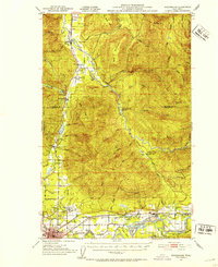
1956 Map of Oso
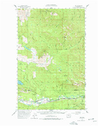
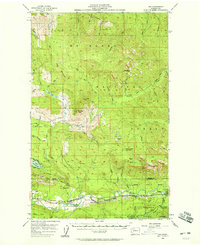
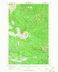
USGS Topo · Published 1977About this map
The North Fork Stillaguamish River corridor defines the southern half of this landscape, serving as the primary artery for both transportation and settlement. The Northern Pacific railroad tracks follow the river's winding path, connecting small communities like Oso, Halterman, Rowan, and Hazel. This rail and river network highlights a mid-century period of established rural infrastructure before the widespread shift away from local rail transport. Further east, the Stillaguamish River passes through the Stillaguamish Country Club Road area near Tulker.
Find a feature on this map
69 named features on this map. Tap any name to fly to it.
Don’t see what you’re looking for? This feature index may not catch every label — zoom into the map to look around manually.
Map Details
Editions of this 1956 Oso Map
Other maps of this area

1899 · Stillaguamish
USGS Topo · 1:125,000

1901 · Stilaguamish
USGS Topo · 1:125,000

1909 · Mt Baker
USGS Topo · 1:192,000

1911 · Mount Vernon
USGS Topo · 1:125,000

1915 · Mt. Baker
USGS Topo · 1:250,000

1921 · Wickersham
USGS Topo · 1:62,500

1941 · Marysville
USGS Topo · 1:62,500

1943 · Marysville
USGS Topo · 1:62,500

1944 · Clear Lake
USGS Topo · 1:62,500
1951 · Wickersham
USGS Topo · 1:62,500