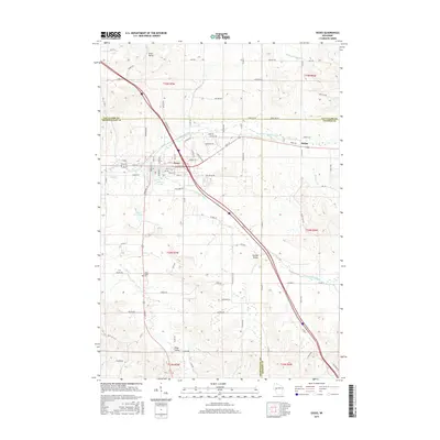
2015 Map of Osseo
USGS Topo · Published 2015About this map
Osseo serves as the central hub of this Wisconsin landscape, situated at the confluence where the N Fork Buffalo River and S Fork Buffalo River merge to form the Buffalo River. The topography is defined by distinct valleys and ridges, including the broad Scott Valley in the northwest and Golden Valley toward the east. This 2015 survey reveals a community deeply connected to its waterways, from the recreational waters of Martha Lake and the Osseo Club Pond to the meandering paths of King Cr and Bears Grass Cr. Beyond the town center, smaller locales like Requa and Kings Valley are linked by a network of rural routes such as Co Hwy G and Tower Rd. Genealogists will find the South Valley Cem located south of the main settlement along Harmony St, a quiet landmark within the rolling agricultural terrain of Trempealeau and Eau Claire counties.
Find a feature on this map
95 named features on this map. Tap any name to fly to it.
Don’t see what you’re looking for? This feature index may not catch every label — zoom into the map to look around manually.
Map Details
Editions of this 2015 Osseo Map
This is the sole edition of this map. No revisions or reprints were ever made.
Other maps of this area

1926 · Whitehall
USGS Topo · 1:62,500

1927 · Blair
USGS Topo · 1:62,500

1927 · Strum
USGS Topo · 1:62,500

1929 · Whitehall
USGS Topo · 1:62,500

1930 · Strum
USGS Topo · 1:62,500

1935 · Osseo
USGS Topo · 1:48,000

1940 · Osseo
USGS Topo · 1:62,500

1953 · Eau Claire
USGS Topo · 1:250,000

1958 · Eau Claire
USGS Topo · 1:250,000

1964 · Eau Claire
USGS Topo · 1:250,000