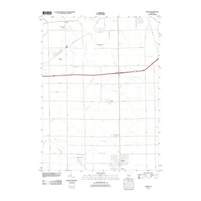
2010 Map of Ossian
USGS Topo · Published 2010About this map
Ossian serves as the primary hub in this portion of Allen County, surrounded by an intricate drainage network that underscores the agricultural foundation of the region. The landscape is defined by the managed flow of water, where natural courses like Eightmile Creek and Robinson Creek are supplemented by numerous man-made channels including Witzgall Ditch, Brindle Ditch, and Harber Ditch. These ditches reflect decades of land reclamation efforts to support the farming operations that dominate the township grid.
Find a feature on this map
60 named features on this map. Tap any name to fly to it.
Don’t see what you’re looking for? This feature index may not catch every label — zoom into the map to look around manually.
Map Details
Editions of this 2010 Ossian Map
This is the sole edition of this map. No revisions or reprints were ever made.
Other maps of this area

1953 · Fort Wayne
USGS Topo · 1:250,000

1953 · Muncie
USGS Topo · 1:250,000

1955 · Markle
USGS Topo · 1:24,000

1956 · Muncie
USGS Topo · 1:250,000

1956 · Fort Wayne
USGS Topo · 1:250,000

1956 · Fort Wayne West
USGS Topo · 1:24,000

1956 · Fort Wayne East
USGS Topo · 1:24,000

1961 · Arcola
USGS Topo · 1:24,000
1961 · Zanesville
USGS Topo · 1:24,000

1962 · Poe
USGS Topo · 1:24,000