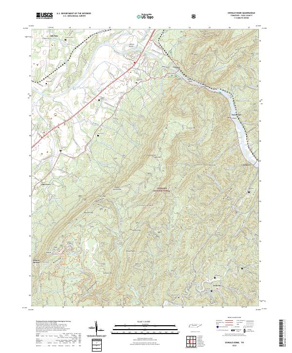
2022 Map of Oswald Dome
USGS Topo · Published 2022About this map
Benton Springs and Old Patty sit at the western edge of this landscape where the valley floor meets the rising elevations of the Cherokee National Forest. The Hiwassee River cuts through the northern portion of the quadrangle, creating a distinct riparian corridor featuring Jenkins Island and Long Island. This waterway remains a primary geographic axis for the settlements of Austral, Hambright, and Reliance.
Find a feature on this map
146 named features on this map. Tap any name to fly to it.
Don’t see what you’re looking for? This feature index may not catch every label — zoom into the map to look around manually.
Map Details
Editions of this 2022 Oswald Dome Map
This is the sole edition of this map. No revisions or reprints were ever made.
Other maps of this area

1886 · Cleveland
USGS Topo · 1:125,000

1892 · Cleveland
USGS Topo · 1:125,000

1893 · Murphy
USGS Topo · 1:125,000

1895 · Cleveland
USGS Topo · 1:125,000

1901 · Cleveland
USGS Topo · 1:125,000

1914 · Murphy
USGS Topo · 1:125,000

1934 · Mecca
USGS Topo · 1:24,000

1935 · Tellico
USGS Topo · 1:48,000

1935 · Calhoun
USGS Topo · 1:24,000

1935 · Benton
USGS Topo · 1:24,000