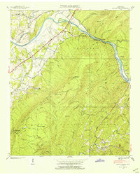
1937 Map of Oswald Dome
USGS Topo · Published 1954About this map
The Hiwassee River snakes through the heart of the Cherokee National Forest in this pre-war survey, revealing a landscape defined by isolated homesteads and river-bottom agriculture. Small communities like Reliance and Hambright cluster along the riverbanks, while the interior is dotted with legacy landmarks like Cloers Mill and Harrison Mill. The terrain is punctuated by significant elevations including Oswald Dome and Chestnut Mountain, which provided vantage points for the forest's Lookout Tower.
Find a feature on this map
72 named features on this map. Tap any name to fly to it.
Don’t see what you’re looking for? This feature index may not catch every label — zoom into the map to look around manually.
Map Details
Editions of this 1937 Oswald Dome Map
This is the sole edition of this map. No revisions or reprints were ever made.
Other maps of this area

1886 · Cleveland
USGS Topo · 1:125,000

1892 · Cleveland
USGS Topo · 1:125,000

1893 · Murphy
USGS Topo · 1:125,000

1895 · Cleveland
USGS Topo · 1:125,000

1901 · Cleveland
USGS Topo · 1:125,000

1914 · Murphy
USGS Topo · 1:125,000

1934 · Mecca
USGS Topo · 1:24,000

1935 · Tellico
USGS Topo · 1:48,000

1935 · Calhoun
USGS Topo · 1:24,000

1935 · Benton
USGS Topo · 1:24,000