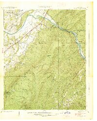
1938 Map of Oswald Dome
USGS Topo · Published 1938About this map
The Hiwassee River carves a deep valley through the heart of the Cherokee National Forest in this 1938 survey, revealing a landscape defined by the convergence of mountain ridges and water-driven industry. The Louisville and Nashville RR follows the northern riverbank, serving small settlements like Austral and Hiwassee Beach. South of the river, the terrain rises sharply toward Oswald Dome, where the Clemmer Trail and various gaps like Mulepen Gap and Sulphur Springs Gap suggest a network of historic passage through the highlands. Local life centers on scattered mills and landmarks, including Harrison Mill and Clemmer Mill, as well as the Antioch Church and Campbellite Cemetery. The map captures the area before modern development, showing isolated schools like Taylor School and Reliance School tucked into the folds of Millstone Ridge and McAmy Ridge.
Find a feature on this map
60 named features on this map. Tap any name to fly to it.
Don’t see what you’re looking for? This feature index may not catch every label — zoom into the map to look around manually.
Map Details
Editions of this 1938 Oswald Dome Map
This is the sole edition of this map. No revisions or reprints were ever made.
Other maps of this area

1886 · Cleveland
USGS Topo · 1:125,000

1892 · Cleveland
USGS Topo · 1:125,000

1893 · Murphy
USGS Topo · 1:125,000

1895 · Cleveland
USGS Topo · 1:125,000

1901 · Cleveland
USGS Topo · 1:125,000

1914 · Murphy
USGS Topo · 1:125,000

1934 · Mecca
USGS Topo · 1:24,000

1935 · Tellico
USGS Topo · 1:48,000

1935 · Calhoun
USGS Topo · 1:24,000

1935 · Benton
USGS Topo · 1:24,000