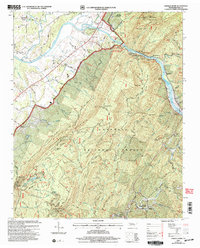
2003 Map of Oswald Dome
USGS Topo · Published 2004About this map
Cherokee National Forest dominates this section of the Tennessee backcountry, where the Hiwassee River cuts a wide path past Jenkins Island and Long Island. The landscape is a complex network of ridges and gaps, centered on the high point of Oswald Dome and the steep slopes of Chilhowee Mountain. Settlement is concentrated in small pockets like Old Patty and Reliance, where the river and local creeks define the community boundaries. Genealogists will find numerous family and community burial grounds, including Nicholson Cem and Bates Cem, alongside established rural congregations such as Mountain View Ch and the House of Prayer. The area is also defined by its recreational development, from the Quinn Springs Recreation Area to the remote Gee Creek Wilderness, showing a transition from traditional river-valley life to protected forest lands.
Find a feature on this map
95 named features on this map. Tap any name to fly to it.
Don’t see what you’re looking for? This feature index may not catch every label — zoom into the map to look around manually.
Map Details
Editions of this 2003 Oswald Dome Map
This is the sole edition of this map. No revisions or reprints were ever made.
Other maps of this area

1886 · Cleveland
USGS Topo · 1:125,000

1892 · Cleveland
USGS Topo · 1:125,000

1893 · Murphy
USGS Topo · 1:125,000

1895 · Cleveland
USGS Topo · 1:125,000

1901 · Cleveland
USGS Topo · 1:125,000

1914 · Murphy
USGS Topo · 1:125,000

1934 · Mecca
USGS Topo · 1:24,000

1935 · Tellico
USGS Topo · 1:48,000

1935 · Calhoun
USGS Topo · 1:24,000

1935 · Benton
USGS Topo · 1:24,000