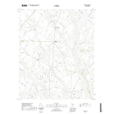
2020 Map of Oswego
USGS Topo · Published 2020About this map
Ashwood and the surrounding rural communities of Lee and Sumter counties are defined by an intricate network of wetlands, including the expansive Scape Ore Swamp and Mechanicsville Swamp. The landscape reveals a long-standing agricultural pattern, with names like Colclough Plantation Rd and W S K Farm Rd hinting at the area's land-use history. Small hubs like DuBose Crossroads and Mechanicsville serve as anchor points in a region primarily shaped by timber and farming.
Find a feature on this map
102 named features on this map. Tap any name to fly to it.
Don’t see what you’re looking for? This feature index may not catch every label — zoom into the map to look around manually.
Map Details
Editions of this 2020 Oswego Map
This is the sole edition of this map. No revisions or reprints were ever made.
Other maps of this area

1920 · Mayesville
USGS Topo · 1:48,000

1921 · Mayesville
USGS Topo · 1:62,500

1941 · Spartanburg
USGS Topo · 1:250,000

1943 · Mayesville
USGS Topo · 1:62,500

1946 · Sumter
USGS Topo · 1:62,500

1953 · Spartanburg
USGS Topo · 1:250,000

1954 · Augusta
USGS Topo · 1:250,000

1957 · Sumter East
USGS Topo · 1:24,000

1957 · Sumter West
USGS Topo · 1:24,000

1957 · Ashwood
USGS Topo · 1:62,500