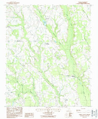
1988 Map of Oswego
USGS Topo · Published 1988About this map
Ashwood Lake and its surrounding community of Ashwood sit at the center of this landscape where the boundaries of Lee and Sumter Counties meet. This late-twentieth-century survey illustrates a region defined by extensive wetland networks, with the wide Scape Ore Swamp and Mechanicsville Swamp carving through the agricultural terrain. The settlement pattern is largely decentralized, following the high ground between these drainage systems. Small rural hubs such as Oswego, DuBose Crossroads, and Woodrow serve as the primary landmarks in an area dominated by timber and low-lying watercourses. To the south, Rocky Bluff Swamp and Lee Swamp further emphasize the hydrological complexity of this coastal plain environment. The map provides a detailed record of the road network connecting these scattered hamlets, alongside various unnamed country cemeteries that offer essential points of interest for those studying local family history.
Find a feature on this map
17 named features on this map. Tap any name to fly to it.
Don’t see what you’re looking for? This feature index may not catch every label — zoom into the map to look around manually.
Map Details
Editions of this 1988 Oswego Map
This is the sole edition of this map. No revisions or reprints were ever made.
Other maps of this area

1920 · Mayesville
USGS Topo · 1:48,000

1921 · Mayesville
USGS Topo · 1:62,500

1941 · Spartanburg
USGS Topo · 1:250,000

1943 · Mayesville
USGS Topo · 1:62,500

1946 · Sumter
USGS Topo · 1:62,500

1953 · Spartanburg
USGS Topo · 1:250,000

1954 · Augusta
USGS Topo · 1:250,000

1957 · Sumter East
USGS Topo · 1:24,000

1957 · Sumter West
USGS Topo · 1:24,000

1957 · Ashwood
USGS Topo · 1:62,500