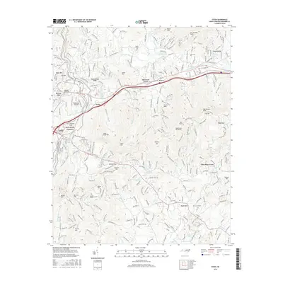
2016 Map of Oteen
USGS Topo · Published 2016About this map
Warren Wilson Coll anchors the northern landscape near the Swannanoa River in this detailed survey of Buncombe County. The terrain is defined by the high peaks of the Swannanoa Mountains, including named heights like High Hickory Knob and Flat Top. Transportation routes reflect the region's development, from the scenic Blue Ridge Parkway winding along the western ridges to the established corridors of Tunnel Rd and the Old Charlotte Hwy. Residential areas such as Grovemont, Swannanoa Hills, and Beverly Hills show the suburban expansion east of Asheville. Local history is preserved in the naming of numerous coves and gaps, alongside family-named sites like Patton Cem and Cane Creek Cem. Small bodies of water like Sherwood Lake and Spivey Lake dot the valleys between the prominent knobs.
Find a feature on this map
72 named features on this map. Tap any name to fly to it.
Don’t see what you’re looking for? This feature index may not catch every label — zoom into the map to look around manually.
Map Details
Editions of this 2016 Oteen Map
This is the sole edition of this map. No revisions or reprints were ever made.
Other maps of this area

1894 · Asheville
USGS Topo · 1:125,000

1900 · Mount Mitchell
USGS Topo · 1:125,000

1901 · Asheville
USGS Topo · 1:125,000

1902 · Mount Mitchell
USGS Topo · 1:125,000

1905 · Pisgah
USGS Topo · 1:125,000

1906 · Pisgah
USGS Topo · 1:125,000

1907 · Saluda
USGS Topo · 1:125,000

1935 · Montreat
USGS Topo · 1:24,000

1935 · Batcave
USGS Topo · 1:24,000

1935 · Black Mountain
USGS Topo · 1:24,000