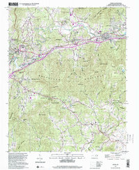
1997 Map of Oteen
USGS Topo · Published 2001About this map
The Swannanoa River valley serves as the central corridor for this Buncombe County landscape, where the Southern railroad and I-40 trace the path of earlier transit routes. Near the confluence of Riceville Creek and the river, Warren Wilson College occupies a significant tract of the valley floor, while the Veterans Administration Hospital stands as a prominent landmark in Oteen. The terrain transitions from these settled lowlands into the high ridges of the Swannanoa Mountains, punctuated by peaks like Chestnut Mountain and Butler Mountain.
Find a feature on this map
77 named features on this map. Tap any name to fly to it.
Don’t see what you’re looking for? This feature index may not catch every label — zoom into the map to look around manually.
Map Details
Editions of this 1997 Oteen Map
This is the sole edition of this map. No revisions or reprints were ever made.
Other maps of this area

1894 · Asheville
USGS Topo · 1:125,000

1900 · Mount Mitchell
USGS Topo · 1:125,000

1901 · Asheville
USGS Topo · 1:125,000

1902 · Mount Mitchell
USGS Topo · 1:125,000

1905 · Pisgah
USGS Topo · 1:125,000

1906 · Pisgah
USGS Topo · 1:125,000

1907 · Saluda
USGS Topo · 1:125,000

1935 · Montreat
USGS Topo · 1:24,000

1935 · Batcave
USGS Topo · 1:24,000

1935 · Black Mountain
USGS Topo · 1:24,000