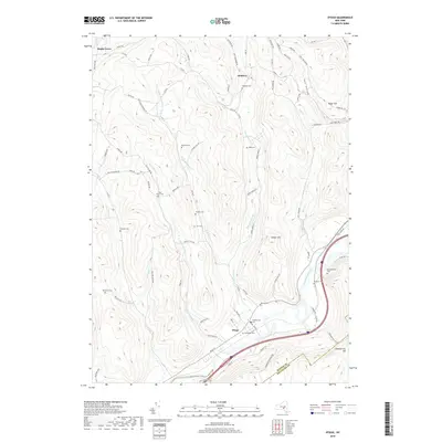
2019 Map of Otego
USGS Topo · Published 2019About this map
The Susquehanna River flows through the southern portion of this region, providing the primary corridor for development and transport near the village of Otego. This area is characterized by a high concentration of small family and community burial grounds, such as Evergreen Cem, Presbyterian Cem, and Burdick Cem, which are scattered among the ridges and valleys. The landscape is defined by the drainage systems of Otsdawa Cr, Flax Island Cr, and Brier Cr, which carve deep paths between elevations like Baker Hill and Chamberlain Hill. The northern settlements of Otsdawa and Maple Grove remain connected by a network of rural routes, including the descriptively named Hell Hollow Rd. The topography illustrates the traditional upstate New York pattern of valley-floor agriculture and hillside forestry, with numerous cemeteries serving as permanent markers of long-established rural lineages.
Find a feature on this map
87 named features on this map. Tap any name to fly to it.
Don’t see what you’re looking for? This feature index may not catch every label — zoom into the map to look around manually.
Map Details
Editions of this 2019 Otego Map
This is the sole edition of this map. No revisions or reprints were ever made.
Other maps of this area

1910 · Hartwick
USGS Topo · 1:62,500

1910 · New Berlin
USGS Topo · 1:62,500

1912 · New Berlin
USGS Topo · 1:62,500

1912 · Hartwick
USGS Topo · 1:62,500

1915 · Oneonta
USGS Topo · 1:62,500

1915 · Unadilla
USGS Topo · 1:62,500

1918 · Unadilla
USGS Topo · 1:62,500

1918 · Oneonta
USGS Topo · 1:62,500

1943 · Mt Vision
USGS Topo · 1:24,000

1943 · New Berlin South
USGS Topo · 1:24,000