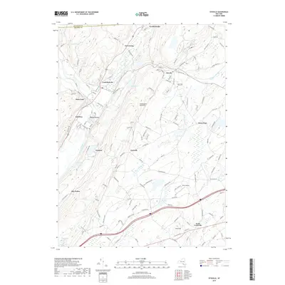
2019 Map of Otisville
USGS Topo · Published 2019About this map
Otisville and the surrounding hamlets of Orange Co occupy a landscape deeply shaped by the Shawangunk Mountains and a series of vital watercourses. The Neversink River carves through the western edge of the sheet near Godeffroy and Roses Point, while the Basher Kill and Shawangunk Kill define the interior drainage patterns. These valley floors have historically served as primary transportation corridors, now utilized by the Metro-North Railroad which connects the clustered settlements of Cuddebackville, Port Orange, and Guymard.
Find a feature on this map
133 named features on this map. Tap any name to fly to it.
Don’t see what you’re looking for? This feature index may not catch every label — zoom into the map to look around manually.
Map Details
Editions of this 2019 Otisville Map
This is the sole edition of this map. No revisions or reprints were ever made.
Other maps of this area

1904 · Ellenville
USGS Topo · 1:62,500

1906 · Ellenville
USGS Topo · 1:62,500

1906 · Port Jervis
USGS Topo · 1:62,500

1906 · Goshen
USGS Topo · 1:62,500

1908 · Goshen
USGS Topo · 1:62,500

1908 · Port Jervis
USGS Topo · 1:62,500

1909 · Monticello
USGS Topo · 1:62,500

1911 · Monticello
USGS Topo · 1:62,500

1938 · Goshen
USGS Topo · 1:62,500

1942 · Pine Island
USGS Topo · 1:24,000