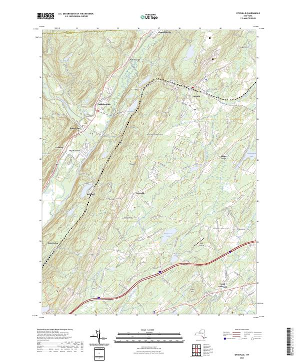
2023 Map of Otisville
USGS Topo · Published 2023About this map
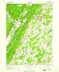
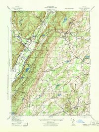
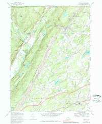
The Shawangunk Mountains divide this landscape, creating a distinct topographical barrier between the Neversink River valley to the west and the Shawangunk Kill drainage to the east. Modern hamlets and historic crossroads such as Otisville, Cuddebackville, and Westbrookville are situated along the lower elevations where transport routes hug the mountain base. The Basher Kill wetlands create a broad, marshy corridor through the western valley, contrasting with the more upland terrain around Mount Hope and South Centerville. Evidence of long-standing community life is found at the Mount Hope Plains Cem, while smaller settlements like Finchville and Godeffroy remain tucked into the foothills. The presence of named water bodies such as Lake Helen, Binnewater Pond, and Shawangunk Lake indicates a landscape heavily influenced by its hydrology and localized valley basins.
Find a feature on this map
139 named features on this map. Tap any name to fly to it.
Don’t see what you’re looking for? This feature index may not catch every label — zoom into the map to look around manually.
Map Details
Editions of this 2023 Otisville Map
This is the sole edition of this map. No revisions or reprints were ever made.
Historical Maps of Glen Park - 15 acres Through Time
4 maps found