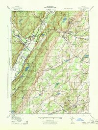
1943 Map of Otisville
USGS Topo · Published 1943About this map
Shawangunk Mountain dominates the center of this terrain, separating the Neversink River valley from the eastern lowlands of Wallkill and Wawayanda. This 1940s Army Map Service survey reveals a complex rail and infrastructure network, featuring the Erie RR and its freight line passing through Otisville, alongside branches reaching toward Cuddebackville and Godeffroy. A notable concentration of public health facilities sits north of Otisville, including the N Y City Municipal Sanatorium and the N Y Board of Health Research Laboratory.
Find a feature on this map
49 named features on this map. Tap any name to fly to it.
Don’t see what you’re looking for? This feature index may not catch every label — zoom into the map to look around manually.
Map Details
Editions of this 1943 Otisville Map
This is the sole edition of this map. No revisions or reprints were ever made.
Other maps of this area

1904 · Ellenville
USGS Topo · 1:62,500

1906 · Ellenville
USGS Topo · 1:62,500

1906 · Port Jervis
USGS Topo · 1:62,500

1906 · Goshen
USGS Topo · 1:62,500

1908 · Goshen
USGS Topo · 1:62,500

1908 · Port Jervis
USGS Topo · 1:62,500

1909 · Monticello
USGS Topo · 1:62,500

1911 · Monticello
USGS Topo · 1:62,500

1938 · Goshen
USGS Topo · 1:62,500

1942 · Pine Island
USGS Topo · 1:24,000