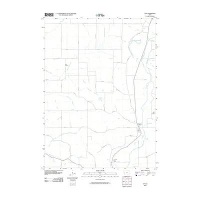
2010 Map of Oto
USGS Topo · Published 2010About this map
The town of Oto sits along the eastern bank of the Little Sioux River in Woodbury County, serving as a focal point for this rural landscape in the early 21st century. The river's historical path is clearly visible through the Old Channel Little Sioux River and the nearby Horseshoe Lake, illustrating how the waterway has shifted over time. This hydrologic activity is further evidenced by several tributaries, including East Fork Wolf Creek, Fern Creek, and Moose Creek, which carve through the agricultural grid.
Find a feature on this map
38 named features on this map. Tap any name to fly to it.
Don’t see what you’re looking for? This feature index may not catch every label — zoom into the map to look around manually.
Map Details
Editions of this 2010 Oto Map
This is the sole edition of this map. No revisions or reprints were ever made.
Other maps of this area

1954 · Fort Dodge
USGS Topo · 1:250,000

1955 · Sioux City
USGS Topo · 1:250,000

1957 · Fort Dodge
USGS Topo · 1:250,000

1958 · Sioux City
USGS Topo · 1:250,000

1958 · Fort Dodge
USGS Topo · 1:250,000

1959 · Sioux City
USGS Topo · 1:250,000

1964 · Climbing Hill
USGS Topo · 1:24,000

1964 · Moville
USGS Topo · 1:24,000

1969 · Mapleton
USGS Topo · 1:24,000

1969 · Correctionville NW
USGS Topo · 1:24,000