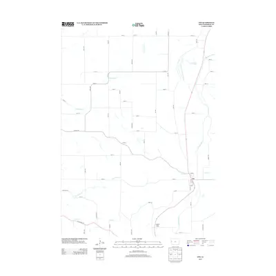
2013 Map of Oto
USGS Topo · Published 2013About this map
The town of Oto sits at the confluence of several key waterways in Woodbury County, anchored by the meandering path of the Little Sioux River. This 2013 landscape reveals a complex hydrological history, most notably evidenced by the Old Channel Little Sioux River and the nearby Horseshoe Lake, which mark the former path of the river before natural or man-made shifts. The drainage network is dense throughout the region, with E Fork Wolf Cr and Lum Hollow Cr feeding into the local basin. Modern recreational use is represented by the Inkpaduta River Access, while the rural grid is defined by a system of gravel and paved roads such as Kossuth Ave and Knox Ave. The topography around Moose Cr and Fern Cr provides a look at the varied elevation and drainage patterns that have historically shaped agriculture and settlement in this part of western Iowa.
Find a feature on this map
45 named features on this map. Tap any name to fly to it.
Don’t see what you’re looking for? This feature index may not catch every label — zoom into the map to look around manually.
Map Details
Editions of this 2013 Oto Map
This is the sole edition of this map. No revisions or reprints were ever made.
Other maps of this area

1954 · Fort Dodge
USGS Topo · 1:250,000

1955 · Sioux City
USGS Topo · 1:250,000

1957 · Fort Dodge
USGS Topo · 1:250,000

1958 · Sioux City
USGS Topo · 1:250,000

1958 · Fort Dodge
USGS Topo · 1:250,000

1959 · Sioux City
USGS Topo · 1:250,000

1964 · Climbing Hill
USGS Topo · 1:24,000

1964 · Moville
USGS Topo · 1:24,000

1969 · Mapleton
USGS Topo · 1:24,000

1969 · Correctionville NW
USGS Topo · 1:24,000