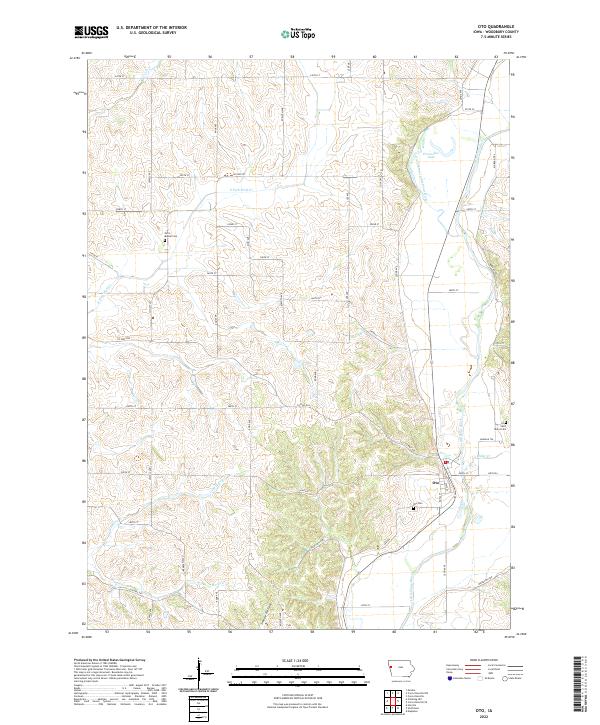
2022 Map of Oto
USGS Topo · Published 2022About this map
Oto is situated at the southeastern bend of the Little Sioux River, where the town's street grid, including State St and Royal St, occupies the lowlands near the riverbanks. The surrounding terrain in Woodbury County is defined by a dense network of drainages and ridges, including the deep cut of Smoky Hollow and the wandering paths of Fern Creek and Miller Creek. A notable hydrological feature is the Old Channel Little Sioux River north of town, which creates Horseshoe Lake, marking where the river once flowed before its course shifted or was modified.
Find a feature on this map
48 named features on this map. Tap any name to fly to it.
Don’t see what you’re looking for? This feature index may not catch every label — zoom into the map to look around manually.
Map Details
Editions of this 2022 Oto Map
This is the sole edition of this map. No revisions or reprints were ever made.
Other maps of this area

1954 · Fort Dodge
USGS Topo · 1:250,000

1955 · Sioux City
USGS Topo · 1:250,000

1957 · Fort Dodge
USGS Topo · 1:250,000

1958 · Sioux City
USGS Topo · 1:250,000

1958 · Fort Dodge
USGS Topo · 1:250,000

1959 · Sioux City
USGS Topo · 1:250,000

1964 · Climbing Hill
USGS Topo · 1:24,000

1964 · Moville
USGS Topo · 1:24,000

1969 · Mapleton
USGS Topo · 1:24,000

1969 · Correctionville NW
USGS Topo · 1:24,000