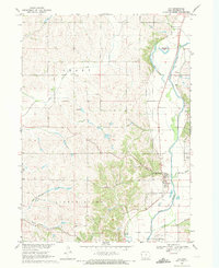
1969 Map of Oto
USGS Topo · Published 1971About this map
The Little Sioux River valley defines the eastern edge of this Woodbury County landscape, where the small settlement of Oto is situated near the junction of Fern Creek and Miller Creek. The river's historical path is visible through the Old Channel and the isolated curve of Horseshoe Lake, illustrating the shifting hydrology of the Iowa Loess Hills region. In the western uplands, the agricultural pattern of Grant township is marked by scattered civic and religious landmarks, including the Townhall and Bethel Ch.
Find a feature on this map
21 named features on this map. Tap any name to fly to it.
Don’t see what you’re looking for? This feature index may not catch every label — zoom into the map to look around manually.
Map Details
Editions of this 1969 Oto Map
This is the sole edition of this map. No revisions or reprints were ever made.
Other maps of this area

1954 · Fort Dodge
USGS Topo · 1:250,000

1955 · Sioux City
USGS Topo · 1:250,000

1957 · Fort Dodge
USGS Topo · 1:250,000

1958 · Sioux City
USGS Topo · 1:250,000

1958 · Fort Dodge
USGS Topo · 1:250,000

1959 · Sioux City
USGS Topo · 1:250,000

1964 · Climbing Hill
USGS Topo · 1:24,000

1964 · Moville
USGS Topo · 1:24,000

1969 · Mapleton
USGS Topo · 1:24,000

1969 · Correctionville NW
USGS Topo · 1:24,000