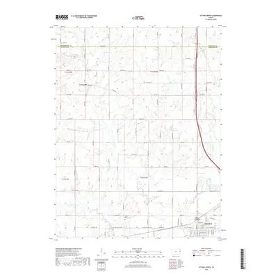
2018 Map of Ottawa North
USGS Topo · Published 2018About this map
Ottawa sits at the southern edge of this landscape, where the urban grid of the northern city limits meets the drainage basins of Appanoose Cr and Eightmile Cr. This rural corridor between Douglas and Franklin counties is characterized by a high density of local landmarks significant to family researchers, including Union Cem near the northern border and Centropolis Cem located just east of the Centropolis settlement. The terrain is marked by notable elevations such as Evergreen Mound, which overlooks the winding course of the creek systems.
Find a feature on this map
59 named features on this map. Tap any name to fly to it.
Don’t see what you’re looking for? This feature index may not catch every label — zoom into the map to look around manually.
Map Details
Editions of this 2018 Ottawa North Map
This is the sole edition of this map. No revisions or reprints were ever made.
Other maps of this area

1885 · Lawrence
USGS Topo · 1:125,000

1889 · Lawrence
USGS Topo · 1:125,000

1947 · Lawrence
USGS Topo · 1:250,000

1950 · Lawrence
USGS Topo · 1:250,000

1955 · Globe
USGS Topo · 1:24,000

1956 · Pomona
USGS Topo · 1:24,000

1956 · Ottawa North
USGS Topo · 1:24,000

1956 · Le Loup
USGS Topo · 1:24,000

1956 · Ottawa South
USGS Topo · 1:24,000

1956 · Lawrence
USGS Topo · 1:250,000