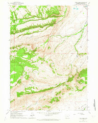
1960 Map of Otter Creek
USGS Topo · Published 1965About this map
Muddy Mountain dominates the center of this Wyoming landscape, where the high-altitude terrain of Natrona County transitions into a series of deeply carved drainage systems. In the early 1960s, the area remained defined by cattle ranching and early irrigation efforts, visible through isolated outposts like the Harris Ranch and the Milne Ranch. The intricate network of waterways, including the Clear Fork Muddy Creek and Beaver Creek, is supplemented by man-made infrastructure such as the Silver State Ditch No 1 and Lone Bear Ditch No 2, indicating the vital role of water management in this arid environment. To the east, the Hogback creates a sharp geological boundary, while the south reveals the open expanse of Deer Creek Park. This survey captures a moment when the rugged sheep and cattle country relied on remote sites like Cow Camp and unpaved routes such as the East End Road.
Find a feature on this map
22 named features on this map. Tap any name to fly to it.
Don’t see what you’re looking for? This feature index may not catch every label — zoom into the map to look around manually.
Map Details
Editions of this 1960 Otter Creek Map
2 editions found
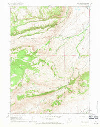
Other maps of this area

1949 · Brookhurst
USGS Topo · 1:24,000

1950 · Lockett
USGS Topo · 1:24,000

1950 · Brookhurst
USGS Topo · 1:24,000

1951 · Casper
USGS Topo · 1:24,000

1955 · Casper
USGS Topo · 1:250,000

1958 · Casper
USGS Topo · 1:250,000

1960 · Crimson Dawn
USGS Topo · 1:24,000

1960 · Sheep Creek
USGS Topo · 1:24,000

1960 · Ice Cave Mountain
USGS Topo · 1:24,000

1960 · Banner Mtn
USGS Topo · 1:24,000