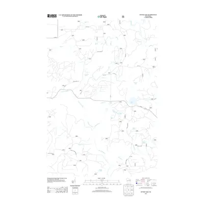
2013 Map of Otter Lake
USGS Topo · Published 2013About this map
Otter Lake and the surrounding Forest County wetlands define this portion of the Wisconsin Northwoods. The landscape is a dense network of glacial water bodies and meandering streams, including Indian Lake, Seal Lake, and the winding N Br Oconto River. The presence of several spring systems, such as Johnson Spring and Camp One Springs, points to the region's complex hydrology. Human activity is marked by a legacy of forest management and recreation, evidenced by Camp Ten and a road system that includes the descriptive Ferry Crossing Ranch Rd. The map also traces the upper reaches of the Rat River, illustrating the watershed divide where numerous creeks like Kufner Cr and Mexico Cr originate. This survey serves as a primary reference for the topography of the Wabeno area, showing the intricate drainage patterns before they join larger river systems.
Find a feature on this map
36 named features on this map. Tap any name to fly to it.
Don’t see what you’re looking for? This feature index may not catch every label — zoom into the map to look around manually.
Map Details
Editions of this 2013 Otter Lake Map
This is the sole edition of this map. No revisions or reprints were ever made.
Other maps of this area

1939 · Goodman
USGS Topo · 1:48,000

1939 · Laona
USGS Topo · 1:48,000

1940 · Thunder Mtn.
USGS Topo · 1:48,000

1942 · Wabeno
USGS Topo · 1:48,000

1946 · Laona
USGS Topo · 1:48,000

1946 · Goodman
USGS Topo · 1:48,000

1950 · Wabeno
USGS Topo · 1:48,000

1951 · Wabeno
USGS Topo · 1:48,000

1951 · Thunder Mountain
USGS Topo · 1:48,000

1954 · Iron Mountain
USGS Topo · 1:250,000