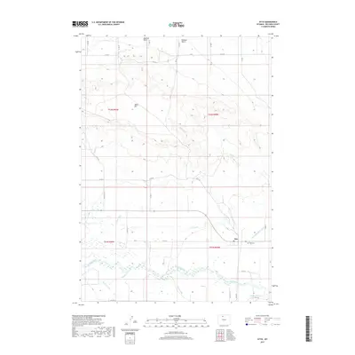
2017 Map of Otto
USGS Topo · Published 2017About this map
The Greybull River meanders through the southern portion of this region, defining a landscape shaped by early 21st-century agricultural irrigation in the Bighorn Basin. The small community of Otto sits near the riverbanks, serving as a focal point for the surrounding rural homesteads. This area is characterized by an extensive network of water management features, including the Perkins Ditch, J F W Ditch, and Fairview Canal, which draw from the river to support the arid lands beneath Emblem Bench.
Find a feature on this map
37 named features on this map. Tap any name to fly to it.
Don’t see what you’re looking for? This feature index may not catch every label — zoom into the map to look around manually.
Map Details
Editions of this 2017 Otto Map
This is the sole edition of this map. No revisions or reprints were ever made.
Other maps of this area

1951 · Burlington
USGS Topo · 1:24,000

1951 · Sheep Mountain
USGS Topo · 1:24,000

1951 · Wardel Reservoir
USGS Topo · 1:24,000

1951 · Otto
USGS Topo · 1:24,000

1955 · Cody
USGS Topo · 1:250,000

1958 · Cody
USGS Topo · 1:250,000

1962 · Cody
USGS Topo · 1:250,000
1966 · Sheep Canyon
USGS Topo · 1:24,000
1966 · Gould Butte
USGS Topo · 1:24,000

1966 · Emblem SE
USGS Topo · 1:24,000