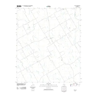
2010 Map of Otto
USGS Topo · Published 2010About this map
Otto anchors this rural central Texas landscape, positioned at the junction of several farm roads during the early twenty-first century. The surrounding terrain is defined by a dense network of watercourses, including the southward-flowing Big Creek, Brushy Creek, and Keechi Creek, which create a complex drainage pattern across the countryside. This era shows a community structured around family and faith, evidenced by the dispersal of numerous burial grounds such as Zion Cemetery, Walker Cemetery, and Hope Cemetery.
Find a feature on this map
51 named features on this map. Tap any name to fly to it.
Don’t see what you’re looking for? This feature index may not catch every label — zoom into the map to look around manually.
Map Details
Editions of this 2010 Otto Map
This is the sole edition of this map. No revisions or reprints were ever made.
Other maps of this area

1920 · Mart
USGS Topo · 1:62,500

1954 · Waco
USGS Topo · 1:250,000

1955 · Waco
USGS Topo · 1:250,000

1956 · Mart
USGS Topo · 1:24,000

1957 · Groesbeck
USGS Topo · 1:62,500

1957 · Otto
USGS Topo · 1:24,000

1957 · McClanahan
USGS Topo · 1:24,000

1957 · Riesel
USGS Topo · 1:24,000

1957 · Marlin
USGS Topo · 1:24,000
1957 · Elk
USGS Topo · 1:24,000