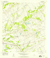
1957 Map of Elk
USGS Topo · Published 1958About this map
Meier Settlement and Hallsburg anchor this mid-century survey of the rural landscape east of Waco, where small community centers are defined by their churches and family cemeteries. The terrain is deeply etched by the drainage systems of Tradinghouse Creek and Riggs Creek, which feed into localized water bodies like New Lake Mart and Battle Lake. Transportation corridors play a central role in the area's layout, with the Missouri Pacific and the Texas and New Orleans railroads cutting through the countryside. Cultural landmarks of the era are visible in the placement of St Josephs Ch, Bethlehem Ch, and the Waco Motorcycle Club, illustrating a transition from traditional agrarian centers to more modern recreational and social gathering points.
Find a feature on this map
30 named features on this map. Tap any name to fly to it.
Don’t see what you’re looking for? This feature index may not catch every label — zoom into the map to look around manually.
Map Details
Editions of this 1957 Elk Map
2 editions found
Other maps of this area

1892 · Temple
USGS Topo · 1:125,000

1892 · Waco
USGS Topo · 1:125,000

1920 · Waco
USGS Topo · 1:125,000

1920 · Mart
USGS Topo · 1:62,500

1931 · Elm Mott
USGS Topo · 1:62,500

1954 · Waco
USGS Topo · 1:250,000

1955 · Waco
USGS Topo · 1:250,000

1956 · Axtell
USGS Topo · 1:24,000

1956 · Mart
USGS Topo · 1:24,000

1957 · Prairie Hill
USGS Topo · 1:24,000