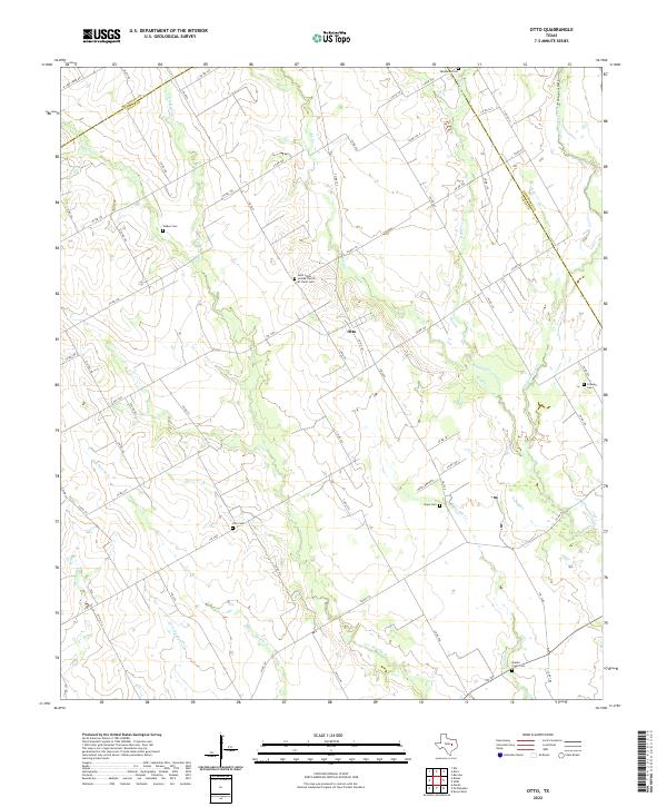
2022 Map of Otto
USGS Topo · Published 2022About this map
The small rural settlement of Otto serves as the focal point for this survey of the Falls County countryside. Situated in a landscape defined by an intricate network of waterways, the area is drained by meandering streams including Big Cr, Keechi Cr, and Hogpen Cr. The map reveals a deeply rooted community structure preserved through numerous family and church burial grounds, such as the Saint Johns United Church of Christ Cem and the Oklahoma Cem.
Find a feature on this map
69 named features on this map. Tap any name to fly to it.
Don’t see what you’re looking for? This feature index may not catch every label — zoom into the map to look around manually.
Map Details
Editions of this 2022 Otto Map
This is the sole edition of this map. No revisions or reprints were ever made.
Other maps of this area

1920 · Mart
USGS Topo · 1:62,500

1954 · Waco
USGS Topo · 1:250,000

1955 · Waco
USGS Topo · 1:250,000

1956 · Mart
USGS Topo · 1:24,000

1957 · Groesbeck
USGS Topo · 1:62,500

1957 · Otto
USGS Topo · 1:24,000

1957 · McClanahan
USGS Topo · 1:24,000

1957 · Riesel
USGS Topo · 1:24,000

1957 · Marlin
USGS Topo · 1:24,000
1957 · Elk
USGS Topo · 1:24,000