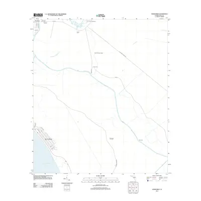
2012 Map of Overstreet
USGS Topo · Published 2012About this map
Overstreet anchors the northern reaches of this Gulf County coastal landscape, where the Intracoastal Waterway carves a path through the low-lying Florida panhandle. The settlement pattern reflects a history of both industrial enterprise and seasonal camps, evidenced by the presence of Ringjaw Camp and Roberts Camp near the winding course of Wetappo Cr. Local landmarks such as the Overstreet Fire Tower and the Sharp Hardy Homestead provide specific points of interest for genealogists and family historians tracing land use in the region.
Find a feature on this map
28 named features on this map. Tap any name to fly to it.
Don’t see what you’re looking for? This feature index may not catch every label — zoom into the map to look around manually.
Map Details
Editions of this 2012 Overstreet Map
This is the sole edition of this map. No revisions or reprints were ever made.
Other maps of this area

1943 · Port St. Joe
USGS Topo · 1:31,680

1943 · Overstreet
USGS Topo · 1:31,680

1944 · Beacon Hill
USGS Topo · 1:31,680

1944 · White City
USGS Topo · 1:24,000

1945 · Lake Wimico
USGS Topo · 1:31,680

1945 · White City
USGS Topo · 1:31,680

1945 · Allanton
USGS Topo · 1:31,680

1945 · Wewahitchka
USGS Topo · 1:31,680

1945 · Wetappo Creek
USGS Topo · 1:31,680

1945 · St Joseph Point
USGS Topo · 1:31,680