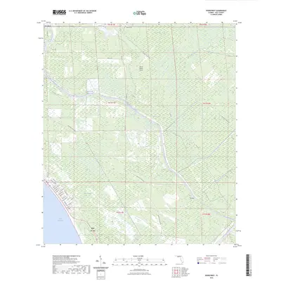
2024 Map of Overstreet
USGS Topo · Published 2024About this map
Saint Joseph Bay anchors the southwestern edge of this coastal landscape, where the growing community of Port St. Joe meets the Gulf of Mexico. This modern survey illustrates a region defined by its water-driven industrial and recreational geography, dominated by the Intracoastal Waterway as it cuts north toward the settlement of Overstreet. The interior terrain is a complex of low-lying wetlands and seasonal drainages, including the expansive Panther Swamp and the densely wooded Gerser Swamp.
Find a feature on this map
51 named features on this map. Tap any name to fly to it.
Don’t see what you’re looking for? This feature index may not catch every label — zoom into the map to look around manually.
Map Details
Editions of this 2024 Overstreet Map
This is the sole edition of this map. No revisions or reprints were ever made.
Other maps of this area

1943 · Port St. Joe
USGS Topo · 1:31,680

1943 · Overstreet
USGS Topo · 1:31,680

1944 · Beacon Hill
USGS Topo · 1:31,680

1944 · White City
USGS Topo · 1:24,000

1945 · Lake Wimico
USGS Topo · 1:31,680

1945 · White City
USGS Topo · 1:31,680

1945 · Allanton
USGS Topo · 1:31,680

1945 · Wewahitchka
USGS Topo · 1:31,680

1945 · Wetappo Creek
USGS Topo · 1:31,680

1945 · St Joseph Point
USGS Topo · 1:31,680