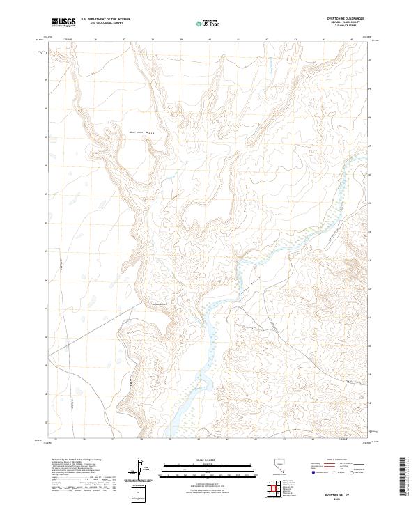
2021 Map of Overton NE
USGS Topo · Published 2021About this map
The Virgin River winds through this arid landscape, carving a path through the Virgin Valley as it flows south toward the edge of the Mojave Desert. The map reveals the dramatic geography of the region, dominated to the west by the high, flat expanse of the Mormon Mesa. This area represents a classic desert drainage system where seasonal watercourses like Halfway Wash feed into the primary river valley, creating a complex network of topographical relief.
Find a feature on this map
11 named features on this map. Tap any name to fly to it.
Don’t see what you’re looking for? This feature index may not catch every label — zoom into the map to look around manually.
Map Details
Editions of this 2021 Overton NE Map
This is the sole edition of this map. No revisions or reprints were ever made.
Other maps of this area

1886 · Saint Thomas
USGS Topo · 1:250,000

1893 · Saint Thomas
USGS Topo · 1:250,000

1954 · Las Vegas
USGS Topo · 1:250,000

1957 · Las Vegas
USGS Topo · 1:250,000

1957 · Mesquite
USGS Topo · 1:62,500

1958 · Virgin Peak
USGS Topo · 1:62,500

1958 · Overton
USGS Topo · 1:62,500

1959 · Las Vegas
USGS Topo · 1:250,000

1962 · Las Vegas
USGS Topo · 1:250,000
1969 · Moapa Peak
USGS Topo · 1:24,000