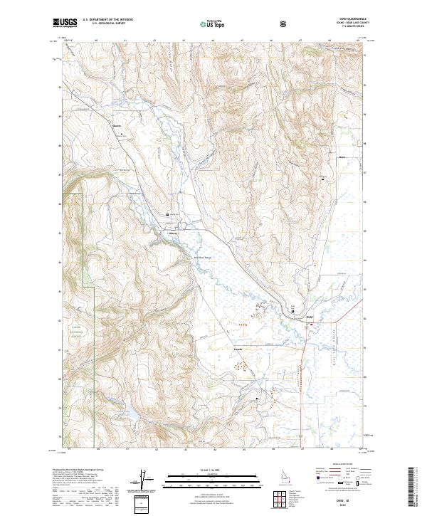
2023 Map of Ovid
USGS Topo · Published 2023About this map
Bear Lake Valley serves as the central pastoral corridor of this quadrangle, where high-altitude agricultural life is anchored by a string of small settlements and their accompanying burial grounds. The communities of Ovid, Lanark, Liberty, Bern, and Sharon follow the edge of the Bear River Range, each maintaining its own distinct legacy through sites like the Ovid Cem and Lanark Cem. The western edge of the map transitions into the steep, timbered slopes of the Cache National Forest, carved by deep drainage systems including Miles Canyon and Morgan Canyon. Water management is central to this high desert landscape, evidenced by the Little Valley Reservoir and numerous named springs such as Crystal Spring and Sago Spring. The map documents a network of local roads, from Old Mill Rd to Sharon Loop, that trace the historic land use patterns of this Bear Lake County region.
Find a feature on this map
68 named features on this map. Tap any name to fly to it.
Don’t see what you’re looking for? This feature index may not catch every label — zoom into the map to look around manually.
Map Details
Editions of this 2023 Ovid Map
This is the sole edition of this map. No revisions or reprints were ever made.
Other maps of this area

1909 · Montpelier
USGS Topo · 1:125,000

1911 · Montpelier
USGS Topo · 1:125,000

1915 · Preston
USGS Topo · 1:96,000

1918 · Preston
USGS Topo · 1:125,000

1955 · Preston
USGS Topo · 1:250,000

1958 · Preston
USGS Topo · 1:250,000

1962 · Preston
USGS Topo · 1:250,000

1967 · Montpelier
USGS Topo · 1:24,000

1967 · Paris
USGS Topo · 1:24,000

1967 · Ovid
USGS Topo · 1:24,000