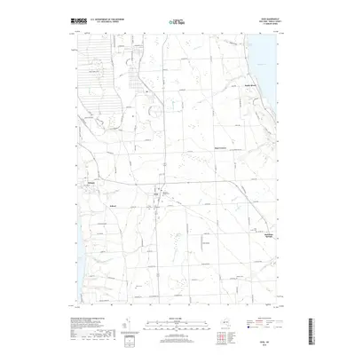
2019 Map of Ovid
USGS Topo · Published 2019About this map
The Seneca Army Depot dominates the northwestern corner of this Finger Lakes landscape, illustrating the significant military footprint remaining in the region during the twenty-first century. Positioned between the deep waters of Seneca Lake and Cayuga Lake, the area is characterized by a high concentration of small agricultural and residential settlements including Ovid, Willard, and Hayt Corners. The terrain is defined by numerous watercourses that drain into the larger lakes, such as Sixteen Falls Cr and Sheldrake Cr, carving landforms like Hicks Gully and Dean Cove. Local history is preserved through a series of burial grounds, notably the Old Ovid Village Cem and Ovid Union Cem, which anchor the community’s genealogical record. The presence of Ovid Airport and several lakeside points like Poplar Beach and Sheldrake Springs highlights the mix of utility and leisure that defines this modern rural corridor.
Find a feature on this map
102 named features on this map. Tap any name to fly to it.
Don’t see what you’re looking for? This feature index may not catch every label — zoom into the map to look around manually.
Map Details
Editions of this 2019 Ovid Map
This is the sole edition of this map. No revisions or reprints were ever made.
Other maps of this area

1899 · Auburn
USGS Topo · 1:62,500

1902 · Geneva
USGS Topo · 1:62,500

1902 · Genoa
USGS Topo · 1:62,500

1902 · Ovid
USGS Topo · 1:62,500

1902 · Auburn
USGS Topo · 1:62,500

1942 · Ovid
USGS Topo · 1:31,680

1942 · Dundee
USGS Topo · 1:24,000

1942 · Lodi
USGS Topo · 1:24,000

1942 · Sheldrake
USGS Topo · 1:24,000

1942 · Trumansburg
USGS Topo · 1:24,000