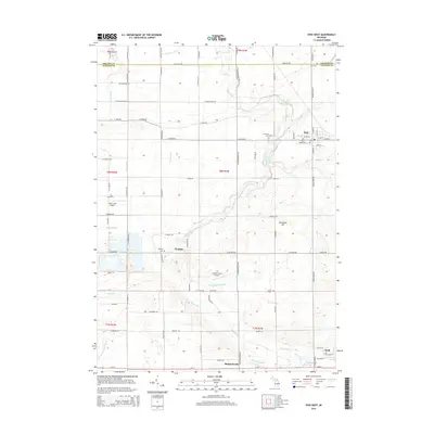
2014 Map of Ovid West
USGS Topo · Published 2014About this map
The Maple River winds through this central Michigan landscape, defining the layout of rural communities along the Gratiot Co Clinton Co border. Small agricultural hubs like Elsie and Duplain are anchored by long-established landmarks, including Riverside Cem and Duplain Cem. The map reveals a highly structured grid of section lines and township roads such as E Colony Rd and E Marshall Rd, which connect the scattered settlements and local landing strips like Tripp Creek Airport. In the southern portion of the quadrangle, the village of Shepardsville sits near the Shepard Drain, while the edge of Ovid appears along E M-21. The intricate drainage network, including Newsom Drain and Halterman Cr, illustrates the extensive water management required for the region's productive farmland during this era of digital cartography.
Find a feature on this map
58 named features on this map. Tap any name to fly to it.
Don’t see what you’re looking for? This feature index may not catch every label — zoom into the map to look around manually.
Map Details
Editions of this 2014 Ovid West Map
This is the sole edition of this map. No revisions or reprints were ever made.
Other maps of this area

1918 · Elsie
USGS Topo · 1:62,500

1918 · Perrinton
USGS Topo · 1:62,500

1927 · De Witt
USGS Topo · 1:62,500

1928 · Laingsburg
USGS Topo · 1:62,500

1943 · Perrinton
USGS Topo · 1:62,500

1943 · Elsie
USGS Topo · 1:62,500

1944 · Laingsburg
USGS Topo · 1:62,500

1954 · Midland
USGS Topo · 1:250,000

1958 · Midland
USGS Topo · 1:250,000

1958 · Grand Rapids
USGS Topo · 1:250,000