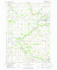
1974 Map of Ovid West
USGS Topo · Published 1978About this map
The Maple River winds through the heart of this mid-Michigan landscape, defining the character of the borderlands between Gratiot and Clinton counties. In the mid-1970s, the village of Elsie stands as a focal point in the northeast, where the Grand Trunk Western railroad corridor remains a significant industrial landmark. The map details a primarily agricultural region interspersed with scattered settlements like Duplain and Shepardsville, while the southern edge is anchored by Ovid.
Find a feature on this map
43 named features on this map. Tap any name to fly to it.
Don’t see what you’re looking for? This feature index may not catch every label — zoom into the map to look around manually.
Map Details
Editions of this 1974 Ovid West Map
This is the sole edition of this map. No revisions or reprints were ever made.
Other maps of this area

1918 · Elsie
USGS Topo · 1:62,500

1918 · Perrinton
USGS Topo · 1:62,500

1927 · De Witt
USGS Topo · 1:62,500

1928 · Laingsburg
USGS Topo · 1:62,500

1943 · Perrinton
USGS Topo · 1:62,500

1943 · Elsie
USGS Topo · 1:62,500

1944 · Laingsburg
USGS Topo · 1:62,500

1954 · Midland
USGS Topo · 1:250,000

1958 · Midland
USGS Topo · 1:250,000

1958 · Grand Rapids
USGS Topo · 1:250,000