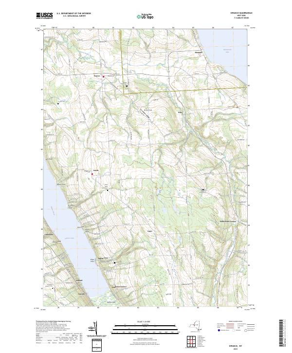
2023 Map of Owasco
USGS Topo · Published 2023About this map
The eastern shore of Owasco Lake and the western edge of Skaneateles Lake define this Finger Lakes landscape, where agricultural uplands meet the narrow glacial valleys of central New York. The community of Owasco serves as a northern anchor, while the southern marshlands of Owasco Flats illustrate the hydrologic transition into the Owasco River. Small hamlets like Niles, Austin, and Omro are connected by a network of rural roads that follow the ridges and valleys, such as Dutch Hollow Brook, which cuts a prominent path through the center of the quadrangle.
Find a feature on this map
109 named features on this map. Tap any name to fly to it.
Don’t see what you’re looking for? This feature index may not catch every label — zoom into the map to look around manually.
Map Details
Editions of this 2023 Owasco Map
This is the sole edition of this map. No revisions or reprints were ever made.
Other maps of this area

1898 · Moravia
USGS Topo · 1:62,500

1899 · Auburn
USGS Topo · 1:62,500

1899 · Skaneateles
USGS Topo · 1:62,500

1902 · Skaneateles
USGS Topo · 1:62,500

1902 · Moravia
USGS Topo · 1:62,500

1902 · Genoa
USGS Topo · 1:62,500

1902 · Auburn
USGS Topo · 1:62,500

1942 · Genoa
USGS Topo · 1:24,000

1943 · Moravia
USGS Topo · 1:31,680
1943 · Genoa
USGS Topo · 1:31,680