
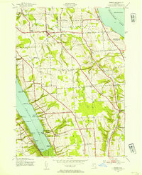
1943 Map of Owasco
USGS Topo · Published 1943About this map
Owasco Lake and Skaneateles Lake frame this Finger Lakes landscape during the early 1940s, a period when the upland between them was defined by a dense network of district schools and rural crossroads. The settlement of Owasco sits at the junction of Dutch Hollow Brook and Baptist Corners Road, serving as a hub for the surrounding agricultural community. The map reveals a high concentration of educational infrastructure, with numerously labeled schools such as School No 12 and School No 6 at Twelve Corners.
Find a feature on this map
65 named features on this map. Tap any name to fly to it.
Don’t see what you’re looking for? This feature index may not catch every label — zoom into the map to look around manually.
Map Details
Editions of this 1943 Owasco Map
2 editions found
Other maps of this area

1898 · Moravia
USGS Topo · 1:62,500

1899 · Auburn
USGS Topo · 1:62,500

1899 · Skaneateles
USGS Topo · 1:62,500

1902 · Skaneateles
USGS Topo · 1:62,500

1902 · Moravia
USGS Topo · 1:62,500

1902 · Genoa
USGS Topo · 1:62,500

1902 · Auburn
USGS Topo · 1:62,500

1942 · Genoa
USGS Topo · 1:24,000

1943 · Moravia
USGS Topo · 1:31,680
1943 · Genoa
USGS Topo · 1:31,680